Map Symbols and Keys: Crack the Map Code with Skye
Learn to read map symbols and keys, including Ordnance Survey symbols, by exploring a UK village and Iceland, then design your own map key.
Online game, chapter 1 free · Years 3 to 6 (KS2) · ages 7–11 · national curriculum in England · no adverts · plays on a phone, tablet or computer · no sign-up to start.
An online earth and geography game for Years 3 to 6 (KS2). It covers the national curriculum in England, Years 3–6 geography: “Use the 8 points of a compass, 4- and 6-figure grid references, symbols and key (including the use of Ordnance Survey maps) to build their knowledge of the United Kingdom and the wider world”.
6 short chapters, about 35 minutes in all. Children can stop after any chapter.
Start playing for free. Plays in the browser on phones, tablets and computers: no app, no adverts.
Free for teachers: every chapter on the whiteboard with a free teacher account.
Last updated · Checked against the national curriculum in England by the TapLearn team
What you'll learn
Why maps use symbols and how a key explains them
Common OS symbols for churches, pubs, schools and post offices
What blue, green and brown mean on an Ordnance Survey map
How to tell footpaths, bridleways, roads and railways apart
How to describe a place using only map symbols
How to design clear symbols and a complete map key
Chapter by chapter
Why maps use symbols and a keyStart playing for free
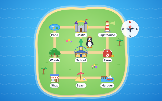
Learn why maps use symbols instead of words and how a key explains them, by tidying a crowded park map, finding places with the key and comparing two maps that use one symbol differently.
Years 3–6 geography · 1
Ordnance Survey symbols for buildings and places
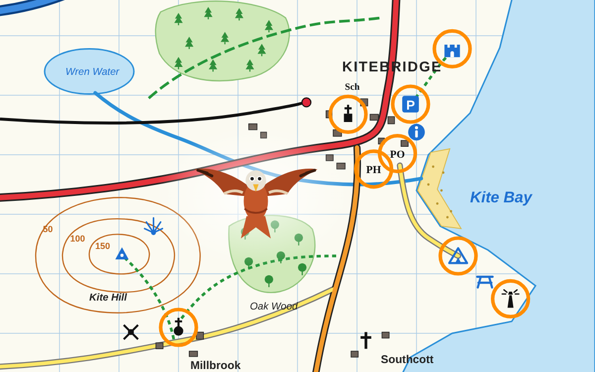
Recognise common Ordnance Survey symbols, such as places of worship with a tower or spire, PH, Sch, PO and blue visitor symbols, by finding them on an OS-style map and building a key.
Years 3–6 geography · 1
Colours and lines on OS maps: water, woods, roads and paths
Read the colours and lines on an OS map: blue water, green woods, coniferous and non-coniferous trees, brown contour lines, motorways, A and B roads, railways, footpaths and bridleways.
Years 3–6 geography · 1
Finding and describing a UK place on an OS map
Use OS symbols to find and describe the features of a UK coastal village, checking true or false statements, sorting physical and human features and writing a short description from the map.
Years 3–6 geography · 1
Reading keys on maps of the wider world
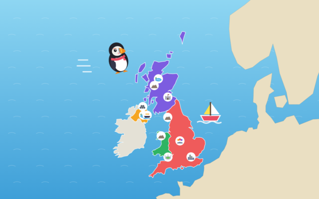
Read an unfamiliar key on a map of Iceland to find a capital city, volcanoes, glaciers, waterfalls and hot springs, and learn that the same symbol can mean different things on different maps.
Years 3–6 geography · 1
Making your own symbols and key
Design simple, different symbols for a school field map and build a complete key, then spot what is wrong with keys that repeat a symbol, leave one out or use too much detail.
What the chapters cover in the national curriculum in England:
Years 3–6 geography: Use the 8 points of a compass, 4- and 6-figure grid references, symbols and key (including the use of Ordnance Survey maps) to build their knowledge of the United Kingdom and the wider world
About this adventure
Map Symbols and Keys is an interactive geography game that teaches children aged 7–11 how to read symbols and keys on maps, including Ordnance Survey (OS) maps, to find and describe places in the UK and further afield.
Guided by Skye the red kite, players swap a crowded map's words for symbols, then use the key to find features. They learn the OS symbols for churches with a tower or spire, pubs (PH), schools (Sch), post offices (PO), car parks and campsites, and what the colours and lines mean: blue water, green woods and footpaths, brown contour lines and coloured roads.
Players act as map detectives, checking facts about a coastal village and sorting physical and human features, then read a new key on a map of Iceland. Finally, they design their own symbols and key, and fix keys that break the rules.
Questions and answers
What is a map key?
A map key, also called a legend, is a box that explains what each symbol, colour and line on a map means. Every map can choose its own symbols, so you should always check that map's key before reading it.
What do PH, PO and Sch mean on an Ordnance Survey map?
On an Ordnance Survey map, PH means public house (a pub), PO means post office and Sch means school. These letter symbols save space, so the map stays clear and easy to read.
How do you tell a church with a tower from a church with a spire on an OS map?
A black square with a cross on top shows a place of worship with a tower, and a black circle with a cross on top shows one with a spire or dome. A cross on its own means it has neither.
What age is this map symbols game for?
The game is designed for children aged 7 to 11 in Key Stage 2, and is mainly pitched at Year 3. It matches the national curriculum aim of using symbols and keys, including Ordnance Survey maps.
What does the map symbols game include and how long does it take?
It has six chapters and a ten-question Map Code Challenge, taking about 35 minutes to play everything. Chapters can be played in any order, with narration, badges and progress saved along the way.
We count visits to make TapLearn better.We use one cookie, only on this site, to see how families find and use it. No adverts, and nothing is shared.One cookie, only on this site. No adverts.How we measure


 TapLearn